
Sandmine's Hidden Roadblock
It is Tuesday, so that means the agenda comes out for the next BOCC meeting next week. This should come around 5pm today and will give us the first look at what is coming to the next BOCC meeting.
Today, we are going back to the Lecanto Sand mine site.
If you remember, a few weeks ago, the sand mine application to expand the mine south got denied by the BOCC. I believe part of that application was also for the mining permit. Regardless if the zoning of the property is Extractive, they still need a mining permit issued by the county to run a sand mine operation. They also need Environmental Resource Permits from the state, which are still pending.
I have been told by the neighbors around the site that they are still running trucks to the site, although not as many as before. They do have an attorney now, so perhaps the attorney has told them to cooperate if they wish to move forward.
A few things have happened recently I want to point out.
1). SWFWMD has included a document in their ERP application file showing that the county had denied the project application.
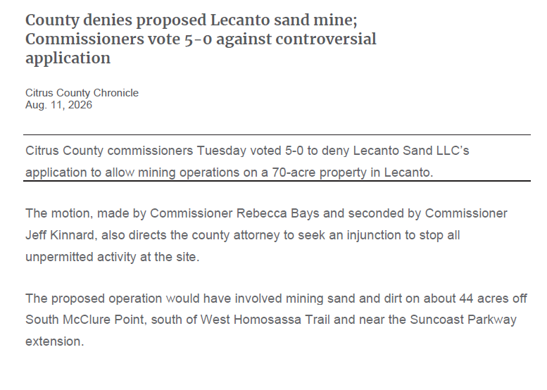
Not sure if this will factor into the ERP decision or not, but SWFWMD is making it known in the file that the county denied the application.
2) SWFWMD sent TWO compliance letters to the owner of the mine on August 12th. This one appears to be a final notice and threatens potential legal action of some sort.
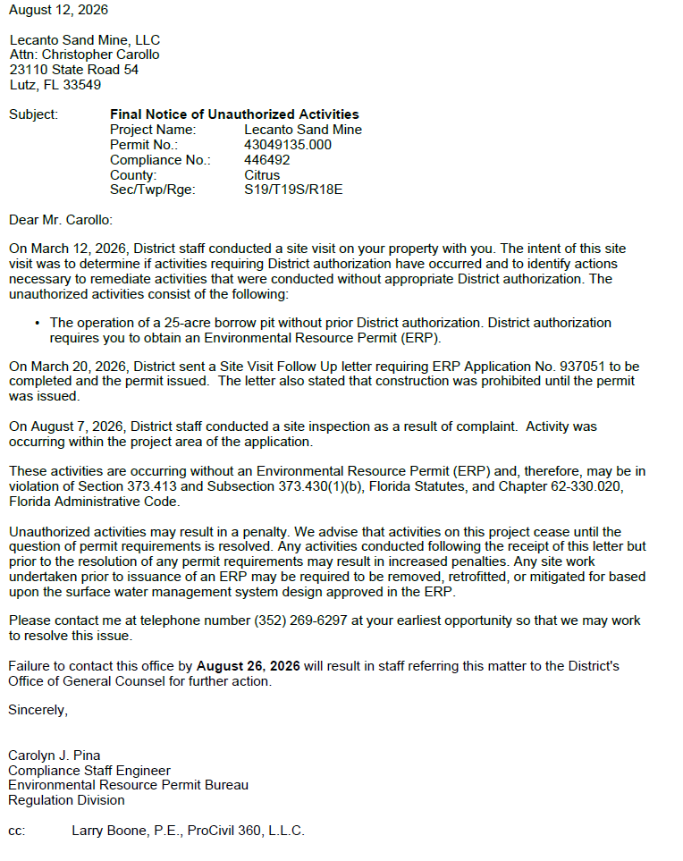
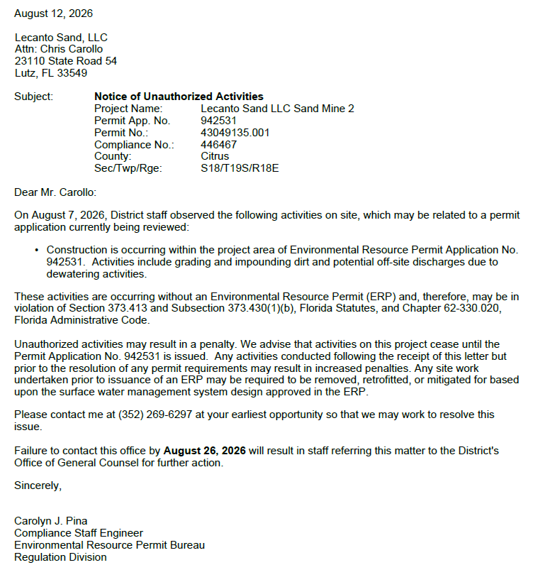
3) The district acknowledges other complaints that have been filed against the owner and the site.
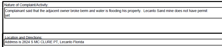
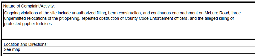
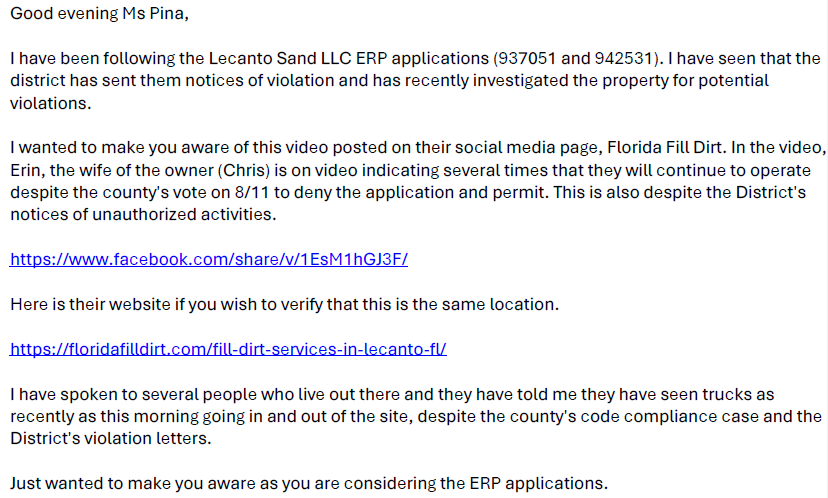
4) SWFWMD does a site visit on August 7th to investigate the complaints and provides 11 pages of photographs. You can view those below
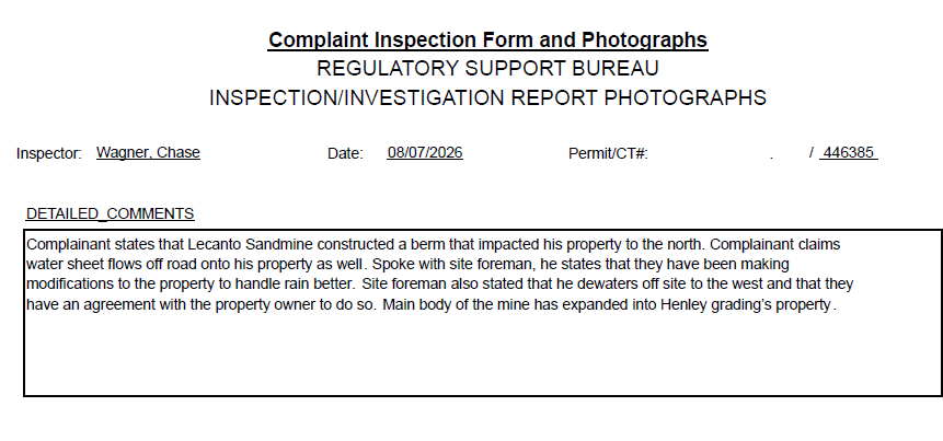
View the entire report from this visit.
So as you can see... Still lots happening at the site over the last couple of weeks.
But one thing that was noticed yesterday that I have no seen mentioned and I wanted to discuss... the road easements.
Taking a look at the GIS, it is clear that McClure Point goes straight down the middle of the mining property.
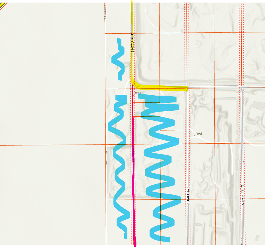
The yellow line is the current dirt road of McClure. The pink line is the easement for McClure. The blue is the mining properties.
I cannot believe I did not notice this before when looking through it all... but there it is. The easement is there for the expansion of McClure and HAS to remain cleared. No mining operations can take place in that easement... and technically the easement is able to be accessed by the public.
If someone wanted to take their 4 wheelers and ride on the easement, they can do so. Nothing can stop them from doing that. Since that is a "road" meant for ingress and egress, nothing can take place in that 50 feet. No mining activity... no berms/walls/etc... nothing. It has to remain clear.
That means if this site were to be allowed to mine, they have to not only keep that 50 foot of easement clear, they have to do the setbacks based on that easement.
Remember those setbacks that the special master said would be allowed to be 150ft... they would have to be 150ft from the easement as well. This is what that will look like.
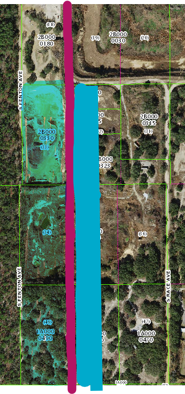
The pink area is the easement for McClure. The teal blue to the right of that line is the 150ft setback from the easement. The blue area I highlighted to the left of the pink line is the 150ft setback from the Fenton Ave property line and the 150ft setback for the McClure easement.
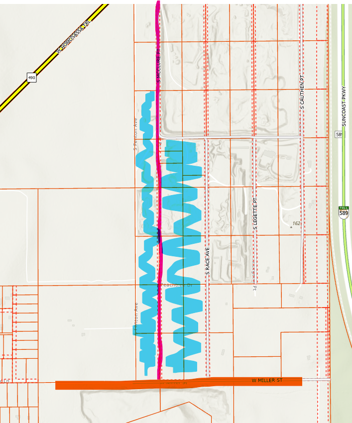
In other words, they cannot mine that entire western portion of the site if the setbacks are kept in place. That easement runs the entire length of the property.
The pink line here is McClure and the easement for it. The blue is the property that Lecanto Sand LLC owns. The orange line at the bottom is the Miller St road.
Since people associated with the mine site tend to read my page and updates, I will prove to you all that this easement exists.
Here are two parcels that Lecanto Sand owns. They are lots 48 and 49.
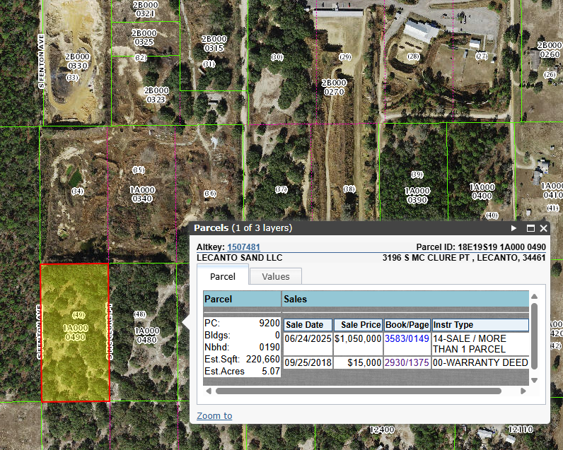
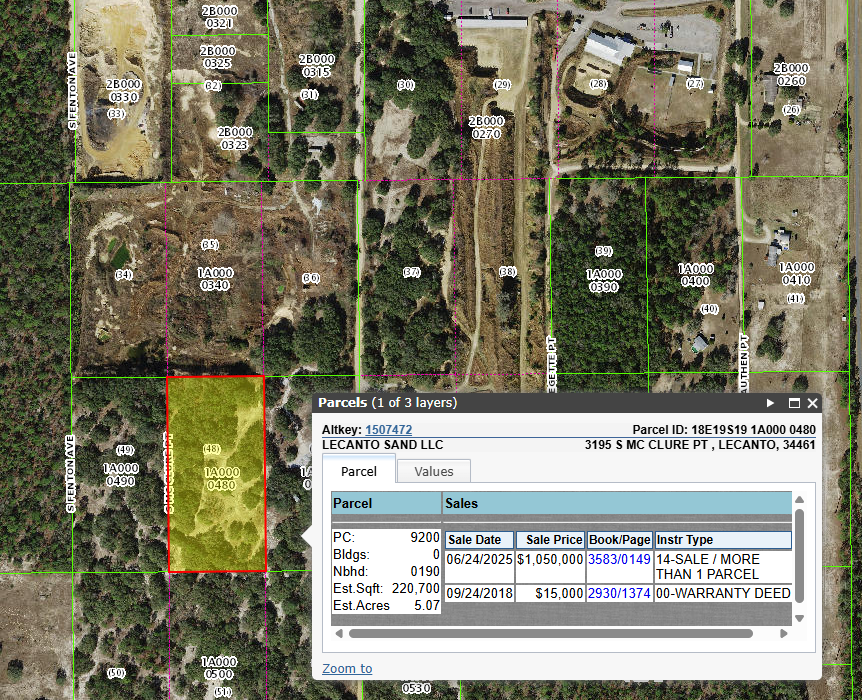
If you go to the deeds from 2018, you will see the easement recorded in the deed for each parcel.
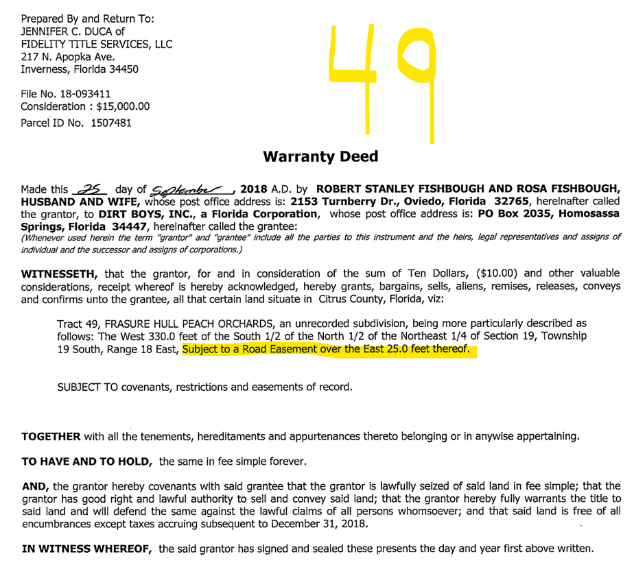
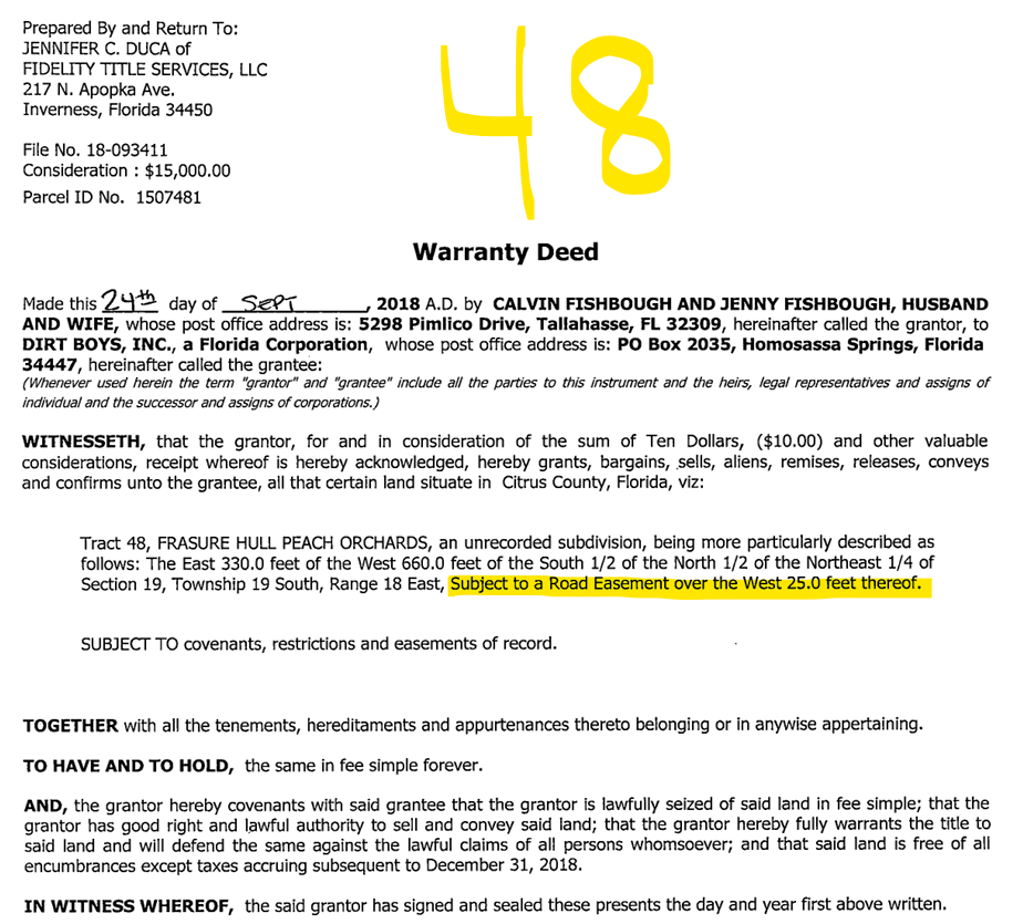
As you can see, lot 49 has a 25ft easement on the eastern side. Lot 48 has a 25ft easement on the western side. This makes the 50ft easement for McClure Point that runs the entire length of the property.
As an easement, the public has the right to access that 50 feet for travel. So again, someone in a 4 wheeler or truck or even walking has the right to utilize that easement for the purpose of travel. Again, this has to remain cleared and CANNOT be mined, unless the easement is vacated.
Since this is on the GIS and the property appraiser website, the easement has NOT been vacated.
I am not sure the county will ever approve the mining permits for this site due to the owner apparently not caring about the code compliance issues and whatnot, but if they do, they have to keep that easement clear and start the setbacks from the easement. That will severely limit what they can mine from these properties.